
Some Specs:
- 360° Vertical Field of View
- Max panoramic resolution of 5400 x 2700
- Less than 1 second reacquisition time
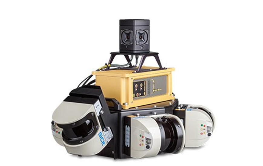
Fully Integrated High Density 3D Laser Scanning and Digital Imagery Mobile Mapping System.
Topcon’s IP-S2 Compact + Mobile Mapping System overcomes the challenges of mapping linear features to a high level of accuracy. Accurate vehicle positions are obtained using three technologies: a dual frequency GNSS receiver establishes a geospatial position; an Inertial Measurement Unit (IMU) tracks vehicle attitude; and connection to external wheel encoders obtains odometry information. These three technologies work together to sustain a highly accurate 3D position for the vehicle even in locations where satellite signals can be blocked by obstructions such as buildings, bridges, or tree lines.